2018 Events
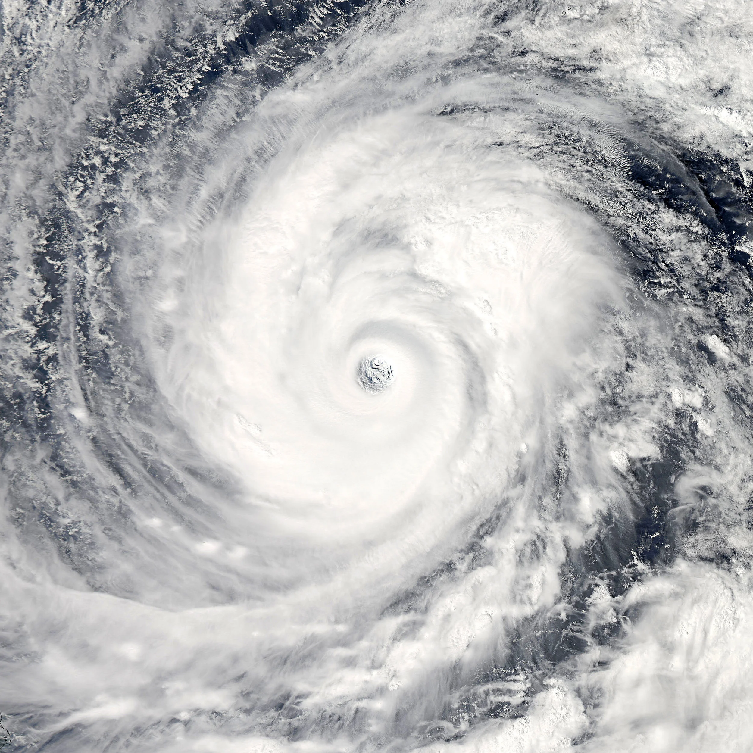
Hurricane Florence (ACTIVE: September 11th - 15th)
Credit: NOAA
Information: Hurricane Florence is currently heading West/Northwest towards North Carolina and Virginia. This storm is expected to reach Category 5 and weaken to a Category 4 as the center of the storm makes landfall between Wilmington, NC and Norfolk, VA. This storm is anticipated to affect jurisdictions ranging from South Carolina to Southern Virginia.
Timetable: Hurricane Florence is expected to make landfall between 12:00 PM Thursday, September 13th to 8:00 PM Thursday, September 13th.
Activation Status: There will be an active event known as VA - Hurricane Florence. No other events in the system will be applicable to this storm.
Applicable events for Hurricane Florence
VA - Hurricane Florence
Activation Note:
The ER-ITN Access Program will try to provide information as soon as possible regarding possible access and checkpoints. Please keep your placard with you when in transit as a precaution in case the information is not made available in a timely manner.
Please visit our other resources for Virginia Reentry to understand how to get registered and receive access for this event
Tropical Storm Gordon (ACTIVE: September 4th-6th)
Information: Tropical Storm Gordon is currently heading towards the Gulf Coast. The storm is expected to bring heavy flooding as well as a maximum sustained windspeed of 70 MPH. This event should produce reentry needs for coastal regions of Mississippi, Louisiana, and possibly Alabama.
Timetable: Tropical Storm Gordon is expected to make landfall between the evening on Tuesday, September 2nd and the morning of Wednesday, September 3rd.
Activation Status: There will be an active event known as Tropical Storm Gordon which will be available for Reentry Placards in Mississippi and Louisiana as a precaution.
Applicable events for Tropical Storm Gordon
LA - All Events
MS - All Events
LA - Tropical Storm Gordon
MS - Tropical Storm Gordon
LA - All Hurricanes
MS - All Hurricanes
LA - (Jurisdiction Specific)
Activation Note:
The ER-ITN Access Program will try to provide information as soon as possible regarding possible access and checkpoints. Please keep your placard with you when in transit as a precaution in case the information is not made available in a timely manner.
Please visit our other resources for MEAP and LSCAP to understand how to get registered and receive access for this event.
For up to date information from Mississippi please visit http://msema.org or https://twitter.com/MSEMA
For up to date information from Louisiana please visit http://emergency.louisiana.gov/ or https://twitter.com/nwsneworleans
Road Closures:
Please visit the Mississippi Department of Transportation (MDOT) closures website for up to date information on road closures https://www.mdottraffic.com/
Tropical Storm Alberto (ACTIVE: May 25th-29th)
SourCE: NOAA
Information: There is a disturbance in the gulf that is projected to turn into a Tropical Storm and reach the northern part of the Gulf Coast by Monday, May 28th. This storm is projected to bring heavy amounts of rain, which may cause regional flooding and road closures in Mississippi.
Timetable: The Tropical Storm is expected to make Landfall in Mississippi, Alabama, and the panhandle of Florida on Monday, May 29th.
Activation Status: There will be an active event known as Tropical Storm Alberto which will be available for Reentry Placards in Mississippi and Louisiana as a precaution.
Applicable events for Tropical Storm Alberto
LA - All Events
MS - All Events
LA - Tropical Storm Alberto
MS - Tropical Storm Alberto
LA - All Hurricanes
MS - All Hurricanes
LA - (Jurisdiction Specific)
Activation Note:
The ER-ITN Access Program will try to provide information as soon as possible regarding possible access and checkpoints. Please keep your placard with you when in transit as a precaution in case the information is not made available in a timely manner.
Please visit our other resources for MEAP and LSCAP to understand how to get registered and receive access for this event.
For up to date information from Mississippi please visit http://msema.org or https://twitter.com/MSEMA
For up to date information from Louisiana please visit http://emergency.louisiana.gov/ or https://twitter.com/nwsneworleans
Road Closures:
Please visit the Mississippi Department of Transportation (MDOT) closures website for up to date information on road closures https://www.mdottraffic.com/
Louisiana/Mississippi Freezing Event (ACTIVE: January 16th-18th)
Information: There are multiple reports of freezing and ice storms on major roadways ranging from Eastern Louisiana to Northern Mississippi. In certain localized areas major roads have been shut down by the state law enforcement in each respective jurisdiction.
Timetable: The major freezing is expected occur between January 16th-17th, with the possibility of some residual freezing on the 18th.
Activation Status: There is no specific activated event as the event has no specific name or location. All events placards and local specific placards will be accepted as per the JSOP in each jurisdiction affected.
Applicable events for Freezing:
LA - All Events
MS - All Events
LA - (Jurisdiction Specific)
Activation Note:
The ER-ITN Access Program will try to provide information as soon as possible regarding possible access and checkpoints. Please keep your placard with you when in transit as a precaution in case the information is not made available in a timely manner.
Please visit the Frequently Asked Questions Section and the LSCAP and MEAP sections for more information regarding how the program operates.
For up to date information from Mississippi please visit http://msema.org or https://twitter.com/MSEMA
For up to date information from Louisiana please visit http://emergency.louisiana.gov/ or https://twitter.com/nwsneworleans
Road Closures:
Please visit the Mississippi Department of Transportation (MDOT) closures website for up to date information on road closures https://www.mdottraffic.com/


